With real-time geospatial data, photorealistic immersive experiences can now be accessed and applied in a wide range of industries. This is what the collaboration between Esri and Unity brings to the world. The launch of ArcGIS Maps SDK for Unity version 1.0 unlocks new capabilities that enable developers to create sophisticated, intuitive, and realistic simulations with real-world applications.
Unlocking New Capabilities by Merging the Real and the Unreal
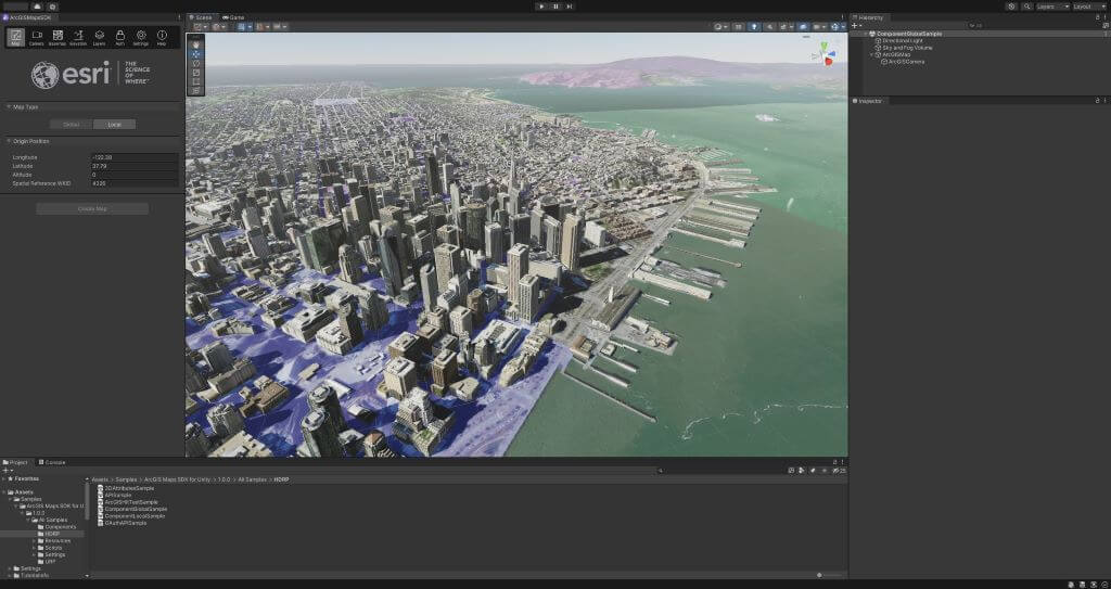
ArcGIS Maps SDK for Unity enables developers to integrate ArcGIS directly into the Unity platform. By merging real-world geospatial data into a robust game engine, developers can create hyperrealistic simulations and fully immersive experiences. They can build new classes of applications beyond the world of gaming.
“With the integration of Unity’s real-time 3D platform, ArcGIS Map SDK lets its users not only envisage and evaluate, but also manage geographical facts and figures for any digital twin model constructed,” said Dave Rhodes, SVP of Digital Twins at Unity, in a blog post.

The applications for ArcGIS Maps SDK for Unity are vast and encompass a wide range of industries including AEC, education, transportation, and public safety. “The collaboration with Esri and Unity will help government agencies, architects and engineers envision, evaluate and analyze how certain changes in a city will look, and how these changes can meet the needs of the future generations, whether it’s the impact of traffic or weather changes,” said Rhodes.
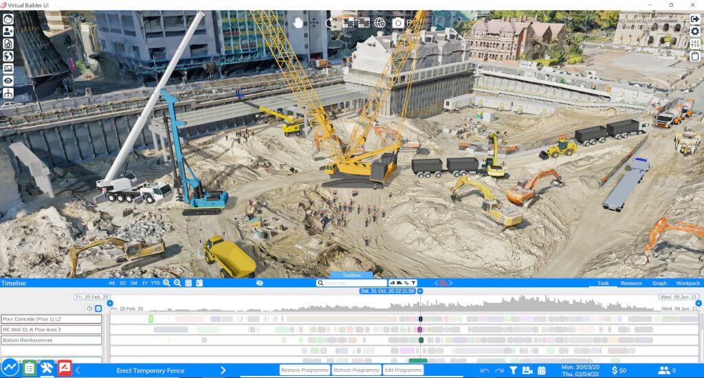
The early adopters of this program include an engineering-led construction firm, CIMIC Group, which uses the plugin to build immersive representations of its projects and monitor progress virtually in real time. “The ArcGIS Maps SDK for Unity allows us to maintain data efficiency and build an immersive representation of the real-world state of a project at any given time,” said Simon Bowles, General manager at EIC Activities, which is part of CIMIC Group.

A Feature-Rich Immersive Application
The collaboration of Esri and Unity paved the way for the development of the High Precision Framework (HPF). This framework allows geographic data to be placed with the accuracy and precision necessary for digital twin applications. This makes it possible to provide geographic coordinate support on a global scale.
Aside from this framework, ArcGIS Maps SDK for Unity version 1.0 includes features that support ArcGIS content types and capabilities. Esri’s global image and global elevation services provide contextual basemaps and real-world terrain elevation. Users can combine multiple layers from different sources concurrently to create richer immersive experiences.

3D Object scene layers allow real-time attributes to be displayed. Integrated Mesh scene layers merge imagery and models of multiple structures into one continuous surface. Data and layers can be read from packages such as TPKs, TPKXs, and SLPKs. Compatibility with any geographic coordinate system allows both global and local coordinates to be used.
With the initial version of ArcGIS Maps SDK for Unity already packed with these advanced features, we can expect future iterations to be even more powerful.
The Freedom to Create Immersive Experiences
The ArcGIS Maps SDK for Unity offers a broad range of applications in various industries. It is available for free download and can be developed, tested, and deployed using a free ArcGIS developer account. It also allows both online and offline access to data through ArcGIS Platform, ArcGIS Online, or ArcGIS Enterprise.
The SDK download comes with tutorials, a conceptual guide, and an API reference. Users can also access the open-source repository of samples for ideas on how to start their projects. With ArcGIS Maps SDK for Unity version 1.0, developers have the freedom to create immersive experiences.


